
Gi en donasjon
Topografisk kart Sitkum
Klikk på kartet for å vise høyde.
Gi en donasjon
Om dette kartet
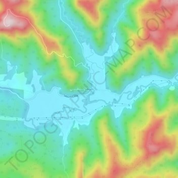
Navn: Topografisk kort Sitkum, højde, relief.
Sted: Sitkum, Coos County, Oregon, United States (43.12817 -123.88120 43.16817 -123.84120)
Gjennomsnittlig høyde: 336 m
Minste høyde: 166 m
Maksimal høyde: 690 m
Gi en donasjon
Andre topografiske kart
Klikk på et kart for å se dets topografi, dets høyde og dets relieff.
Coos Bay
United States > Oregon > Coos County
According to the United States Census Bureau, the city has a total area of 15.90 square miles (41.18 km2), of which, 10.60 square miles (27.45 km2) is land and 5.30 square miles (13.73 km2) is water. The city is quite hilly, with elevations ranging from between sea level to over 500 feet (150 m). Bodies of…
Gjennomsnittlig høyde: 30 m
Gi en donasjon