

Gi en donasjon
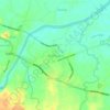
Topografisk kart Daet
Klikk på kartet for å vise høyde.
Gi en donasjon
Daet
Daet is located in the southeastern part of Camarines Norte. It is bounded in the east by the town of Mercedes; in the south by the municipality of Basud; in southwest by San Lorenzo Ruiz town; in the north by Pacific Ocean; in the west by San Vicente and northwest by Talisay. The provincial capital covers a total land area of 5,861.48 hectares. The landscape of Daet is primarily composed of plains or flatlands, with no significant mountains or valleys. The average elevation of the area is approximately 10 meters above sea level.
Gi en donasjon
Om dette kartet

Navn: Topografisk kort Daet, højde, relief.
Sted: Daet, Camarines Norte, Bicol Region, 4600, Philippines (14.07362 122.89669 14.26107 123.07859)
Gjennomsnittlig høyde: 6 m
Minste høyde: -1 m
Maksimal høyde: 114 m
Gi en donasjon
Andre topografiske kart
Klikk på et kart for å se dets topografi, dets høyde og dets relieff.


Gi en donasjon


Gi en donasjon


Talisay
The fertile soil, topography (averaging about 10 metres (33 ft) above sea-level) and suitable climate are the main reasons why agriculture is the economic backbone of the town. Rice and coconut farming are the major agricultural activities for most of the barangays and fishing is the second thriving industry…
Gjennomsnittlig høyde: 10 m
Gi en donasjon


Gi en donasjon


Gi en donasjon


Gi en donasjon


Gi en donasjon


Gi en donasjon


Gi en donasjon


Gi en donasjon


Gi en donasjon


Gi en donasjon


Gi en donasjon


Gi en donasjon



Gi en donasjon


Gi en donasjon

Gi en donasjon


Gi en donasjon

Gi en donasjon