
Takk for at du støtter denne siden ❤️
Gi en donasjon
Gi en donasjon
Topografisk kart Hillary Step
Klikk på kartet for å vise høyde.
Takk for at du støtter denne siden ❤️
Gi en donasjon
Gi en donasjon
Hillary Step
The step was named after Sir Edmund Hillary, who was the first known person, along with Tenzing Norgay, to scale it on the way to the summit during the 1953 British Mount Everest Expedition. Hillary and Tenzing first climbed the Hillary Step on 29 May 1953 by climbing the crack between the snow and the rock. Hillary reported that the snow on the step was harder than at lower elevation. Hillary wrote in 1953.
Takk for at du støtter denne siden ❤️
Gi en donasjon
Gi en donasjon
Om dette kartet
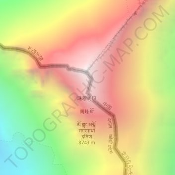
Navn: Topografisk kort Hillary Step, højde, relief.
Gjennomsnittlig høyde: 7 824 m
Minste høyde: 6 597 m
Maksimal høyde: 8 849 m
Takk for at du støtter denne siden ❤️
Gi en donasjon
Gi en donasjon
Andre topografiske kart
Klikk på et kart for å se dets topografi, dets høyde og dets relieff.