
Takk for at du støtter denne siden ❤️
Gi en donasjon
Gi en donasjon
Topografisk kart Pine
Klikk på kartet for å vise høyde.
Takk for at du støtter denne siden ❤️
Gi en donasjon
Gi en donasjon
Pine
Pine and the adjacent community of Strawberry are rapidly growing vacation and retirement centers in north-central Arizona, below the Mogollon Rim. Pine's elevation is 5,448 feet (1,661 m), and the Pine post office was established in 1884.
Takk for at du støtter denne siden ❤️
Gi en donasjon
Gi en donasjon
Om dette kartet
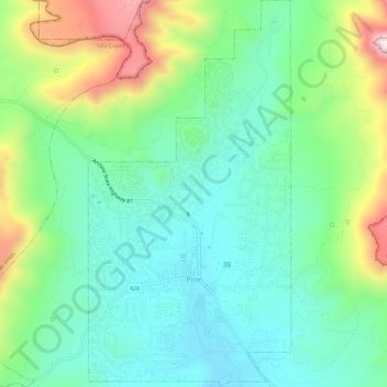
Navn: Topografisk kort Pine, højde, relief.
Sted: Pine, Gila County, Arizona, United States (34.37097 -111.47143 34.41879 -111.44099)
Gjennomsnittlig høyde: 1 794 m
Minste høyde: 1 613 m
Maksimal høyde: 2 221 m
Takk for at du støtter denne siden ❤️
Gi en donasjon
Gi en donasjon