
Gi en donasjon
Topografisk kart Hillsboro
Klikk på kartet for å vise høyde.
Gi en donasjon
Om dette kartet
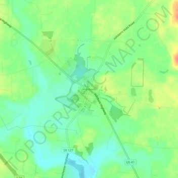
Navn: Topografisk kort Hillsboro, højde, relief.
Gjennomsnittlig høyde: 323 m
Minste høyde: 304 m
Maksimal høyde: 364 m
Gi en donasjon
Andre topografiske kart
Klikk på et kart for å se dets topografi, dets høyde og dets relieff.
Tullahoma
United States > Tennessee > Coffee County
Tullahoma is located in the southwest corner of Coffee County at 35°22′7″N 86°12′48″W / 35.36861°N 86.21333°W / 35.36861; -86.21333 (35.368511, -86.213258), and extends south into Franklin County. It is situated at the edge of the Highland Rim, with flatter topography than in the…
Gjennomsnittlig høyde: 323 m
Gi en donasjon