
Gi en donasjon
Topografisk kart Smith Beach
Klikk på kartet for å vise høyde.
Gi en donasjon
Om dette kartet
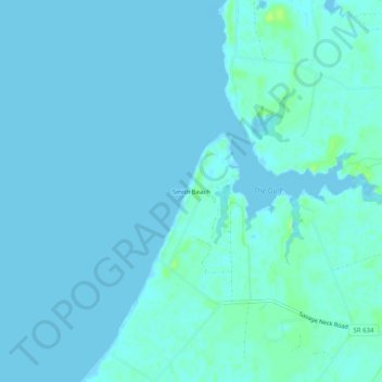
Navn: Topografisk kort Smith Beach, højde, relief.
Gjennomsnittlig høyde: 2 m
Minste høyde: -5 m
Maksimal høyde: 13 m
Gi en donasjon
Andre topografiske kart
Klikk på et kart for å se dets topografi, dets høyde og dets relieff.
Gi en donasjon
Cape Charles
United States > Virginia > Northampton County
Cape Charles lies on a peninsula and is surrounded by water on three sides. The town is situated directly on the Chesapeake Bay, bordered by King's Creek to the north and Old Plantation Creek to the south. The land in town is low lying and relatively flat, with the highest point of elevation at 15 feet, and a…
Gjennomsnittlig høyde: 2 m
Gi en donasjon