
Takk for at du støtter denne siden ❤️
Gi en donasjon
Gi en donasjon
Topografisk kart Jerimoth Hill
Klikk på kartet for å vise høyde.
Takk for at du støtter denne siden ❤️
Gi en donasjon
Gi en donasjon
Jerimoth Hill
The hill is located on Route 101 in Foster, a half mile from the Connecticut line. To ascend the summit, for which there is a sign, there is a .3-mile (480 m) long trail that has a mere 10-foot (3.0 m) elevation gain. The hill is 812 feet (247 m) high and is located 15 miles (24 km) west of Providence, Rhode Island, and 35 miles (56 km) east of Willimantic, Connecticut.
Takk for at du støtter denne siden ❤️
Gi en donasjon
Gi en donasjon
Om dette kartet
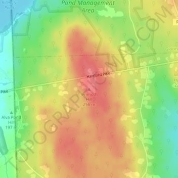
Navn: Topografisk kort Jerimoth Hill, højde, relief.
Gjennomsnittlig høyde: 216 m
Minste høyde: 176 m
Maksimal høyde: 247 m
Takk for at du støtter denne siden ❤️
Gi en donasjon
Gi en donasjon