
Gi en donasjon
Topografisk kart Demory
Klikk på kartet for å vise høyde.
Gi en donasjon
Om dette kartet
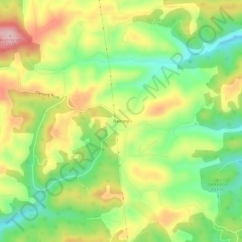
Navn: Topografisk kort Demory, højde, relief.
Gjennomsnittlig høyde: 406 m
Minste høyde: 305 m
Maksimal høyde: 529 m
Gi en donasjon
Andre topografiske kart
Klikk på et kart for å se dets topografi, dets høyde og dets relieff.
La Follette
United States > Tennessee > Campbell County
According to the United States Census Bureau, the city has a total area of 4.9 sq mi (12.7 km2), all land. The elevation varies around the city, around 1,050 ft (320 m) in the valley areas to 1,500 ft (460 m) on ridge tops. The average elevation is around 1,150 ft (350 m).
Gjennomsnittlig høyde: 396 m
Gi en donasjon