
Takk for at du støtter denne siden ❤️
Gi en donasjon
Gi en donasjon
Topografisk kart Joe Neets
Klikk på kartet for å vise høyde.
Takk for at du støtter denne siden ❤️
Gi en donasjon
Gi en donasjon
Om dette kartet
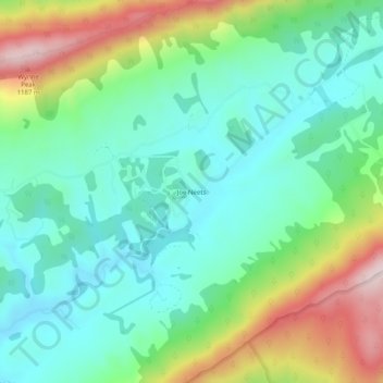
Navn: Topografisk kort Joe Neets, højde, relief.
Sted: Joe Neets, Tazewell County, Virginia, United States (37.06262 -81.49844 37.10262 -81.45844)
Gjennomsnittlig høyde: 963 m
Minste høyde: 820 m
Maksimal høyde: 1 284 m
Takk for at du støtter denne siden ❤️
Gi en donasjon
Gi en donasjon
Andre topografiske kart
Klikk på et kart for å se dets topografi, dets høyde og dets relieff.