
Takk for at du støtter denne siden ❤️
Gi en donasjon
Gi en donasjon
Topografisk kart Hulbert
Klikk på kartet for å vise høyde.
Takk for at du støtter denne siden ❤️
Gi en donasjon
Gi en donasjon
Hulbert
Hulbert is a rural community in western Chippewa County in the Upper Peninsula. The community is located within Hulbert Township about 40 miles (64 km) south of the Tahquamenon Falls. The community sits at an elevation of 751 feet (229 m) above sea level.
Takk for at du støtter denne siden ❤️
Gi en donasjon
Gi en donasjon
Om dette kartet
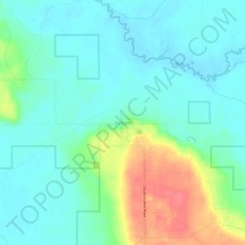
Navn: Topografisk kort Hulbert, højde, relief.
Gjennomsnittlig høyde: 231 m
Minste høyde: 213 m
Maksimal høyde: 277 m
Takk for at du støtter denne siden ❤️
Gi en donasjon
Gi en donasjon